Tuesday, March 27, 2012

Hiking: Fourth 10-mile trip plan REVISED

Sunrise on the Embudito Trail
It's time to plan for my fourth 10-miler - again. Last weekend, I planned to hike 5.25 miles along the Embudito Trail, into Sandia Wilderness, to reach the South Peak close to where it runs into the Crest Trail. Due to lingering ice about halfway up, I was turned back and hiked only five miles or so.

I was bummed, and I've been wracking my brain all week to come up with an interesting hike - one with pay off - that I could do before the mountains' final thaw. Also, I'm being mindful of spending money and wasting gas, which is why I haven't opted for some of the nice peaks south of Albuquerque or closer to Arizona. I just can't afford it.

So with that in mind, I've come up with a modified trip plan, one that incorporates what I did this past weekend with a 100 percent reliance on public transportation. Since I have a bus pass from work, this trip won't cost me a dime!

The only problem is that the merit badge guidelines call for a hike over 10 contiguous miles. For this trip plan, though, I'm making an exception. How can an hour-long bus ride after the first two miles of hiking be considered any different than sitting under a shade tree enjoying lunch on a "contiguous" hike? It couldn't...and if it could, oh well. I'm doing this for me, remember!

So here's the plan. I will set out from my front door at around 8 a.m. and walk two miles on slightly hilly street terrain along Girard Street to its intersection at Lomas Boulavard. There I will wait for the 8:21 a.m. Route 5 bus (ABQ Ride) to arrive at the Montgomery/Tramway Park and Ride by 9:08. (I'll read up on wilderness survival and Leave No Trace principles along the way).

From there, I may grab a coffee at the Starbucks there and begin the mile walk up hill through the Glenwood Hills neighborhood to the Embudito Trail Head. So before even stepping onto the trail I will have hiked a good three miles.

I'll do the same hike as this past weekend, which I wrote about here, and from the trail head home I'll just retrace the steps outlined above. I'll catch the 2:03 p.m. to arrive at Lomas and Girard by 2:53 p.m. and walk the last two miles home. This makes the hike a total of 11 miles, and I'll be home by 3:30 or 4 p.m. at the latest, just in time to cook a nice dinner and relax with my boys.

NOTE: Considering that I walk my dogs a minimum of one mile each morning and each evening, I will be walking a total 13 miles on Saturday. So I will definitely plan on chilling on Sunday!
Sunday, March 25, 2012

Hiking: Ice turns me back at the halfway point

Making my way through Embudito Canyon
Well, Saturday's hike on the Embudito Trail in the southern Sandias didn't turn out to be my fourth 10-miler after all. I suspected I might encounter some leftover snow and ice at the higher altitudes, but I was hoping it wouldn't turn me back from reaching the crest. In any case, I made it all the way through the gorgeous canyon to approximately the halfway point at the beginning of the first onset of thick Douglas Fir forest that is apparently what makes this hike spectacular.

At the two-mile point there was a clearing with an amazing view toward the east of pure Sandia wilderness. I felt like John Denver, and as I started to sing Rocky Mountain High at full volume, I realized I wasn't alone. Just then, a man in his sixties, and with him a man in his mid- to late-20s who appeared to be his grandson, crested the hill from the other direction.

The two were kind, and both wore bearded smiles. The older one came up the hill first. He was trucking along at a good clip, decked out in hard core surplus gear, a pair of ice spikes dangling on a piece of rawhide from his neck. The younger one was shirtless, well defined, and smoking a pipe. They seemed amused when I stopped singing abruptly and quickly engaged me in conversation about the beautiful weather.

Embudito got icy around 2.5 miles along
I commented on the ice spikes and asked if I'd be able to make it to the crest without them. They warned me of the slick conditions I'd hit once I made it down into thick pine forest about a half mile on. They said I still had a half mile or so to go before it became impassable without special gear. And they encouraged me to check it out, so I continued on, counting my steps to estimate the distance (and the old man was pretty spot on).

After being turned back by the ice as predicted, I arrived again at the clearing and found the two mountain men lunching on a big boulder nearby. They waved me over, and as I ate my PBJs the old man shared mountain lore while his grandson puffed on his pipe and smiled.

I left them there after a few moments, and as I was making my way back down the along the northern wall of the canyon, I got a bit ahead of myself and winded up slipping on a steep and gravely slope. I reached out on either side as my feet slipped from under me, grabbing a prickly cactus on one side and a sharp granite boulder on the other. Besides getting the wind knocked out of me and a quarter-inch long slice along my left thumb (which bled a surprising amount), I came out fairly unscathed.

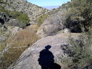
Looking back, Embudito Canyon, returning to the trail head
At the end of the hike I had tons of energy and wanted to go another five miles, but I was bummed that I wasn't going to reach the crest as planned. So instead of meandering along the foothills, I went home and chilled with my pups, Remington and Diego.

I'm looking into a different plan for my next 10-miler since the one I posted on Friday night will likely have to wait a few weeks until the spring has had more time to work it's magic on the upper reaches of the mountain. But I WILL get a 10-mile hike in soon, preferably this coming weekend.

On a side note, I have wanted to buy ice spikes ever since I arrived here in January, but they cost about $60, and this move has kicked my budget's butt! I just got my 2011 dividend from REI, so I'm planning to check them out this weekend for a possible late season sale on winter equipment. That way I'll be prepared for next year!

Friday, March 23, 2012

Hiking: Fourth 10-miler will be my biggest hike yet! (SEE POSTSCRIPT)

Finally, the time has come for me to set out on my fourth of five ten-milers as I make my way toward completing the requirements for the Boy Scouts merit badge for hiking. For anyone who's catching this blog for the first time, I'm not a Boy Scout now, though I once was. I'm doing this as a sort of mid-life project. I've gotten a second lease on life, having lost more than 150 pounds in the past few years, and I'm celebrating by getting out there and living like I've never lived before!

So that brings me to where I am now. I'm sitting in the Starbucks in the Nob Hill neighborhood of Albuquerque on the eve before my first attempt at making it from the Sandia Foothills up to the Crest Trail. Tomorrow morning, sometime around 8:30 I'm thinking, I'll head to the trail head at the end of Montgomery Boulevard off of Glenwood Hills Drive.

The trail I'm looking for is Embudito. This trail goes up through a canyon from the desert area below through a lush pine forest. It's about 5.25 miles from the trail head to the peak, and I'll take the same trail back down, which means I'll be hiking a total of 10.5 miles round trip.

The trail up is relentless from what I've read in all of the trail guides. It may take about five hours to make it to the top and then about two or three to make it back down, so I'm packing plenty of trail rations and extra water - about three liters in all.

At the four mile point, Oso Pass, I may decide to turn back if there's still snow and ice at the top. But I'm hoping I'll be able to make it the entire way so I can check this fourth hike off my list and plan for my final ten miler. Then I'll be able to start seriously thinking about my 20 mile capstone hike. What an accomplishment that will be!

I wish I had someone to hike with tomorrow, but I've asked around and no one seems to be up for such an intense excursion. I'll be careful, though, and I'll tell my aunt where I'm heading and make plans to check in with her when I'm back down the mountain. If she doesn't hear from me by 5 p.m. she'll know I'm in trouble and be able to contact the necessary folks to come looking for me.

Yikes, that makes me nervous just mentioning that part. But it's part of being prepared, so there you have it. I'm taking extra socks, some warm clothing to account for climate changes as I make it up the more than 3,000 foot elevation change from the foothills to the crest. (Double yikes!)

POSTSCRIPT - See what happened on this hike in my next blog post. Spoiler alert: I was turned back by ice halfway up the mountain!